
Emergency Transportation Routes
Regional Emergency Transportation Routes (ETRs) are defined as priority routes targeted during an emergency for rapid damage assessment and debris-clearance. They are used to facilitate life-saving and life-sustaining response activities, including the transport of first responders (e.g., police, fire and emergency medical services), fuel, essential supplies and patients.
PROJECT BACKGROUND & GROUNDWORK
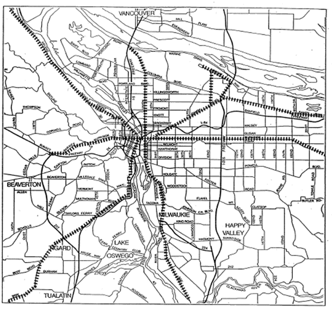
Designated Emergency Lifeline Corridors (1994)
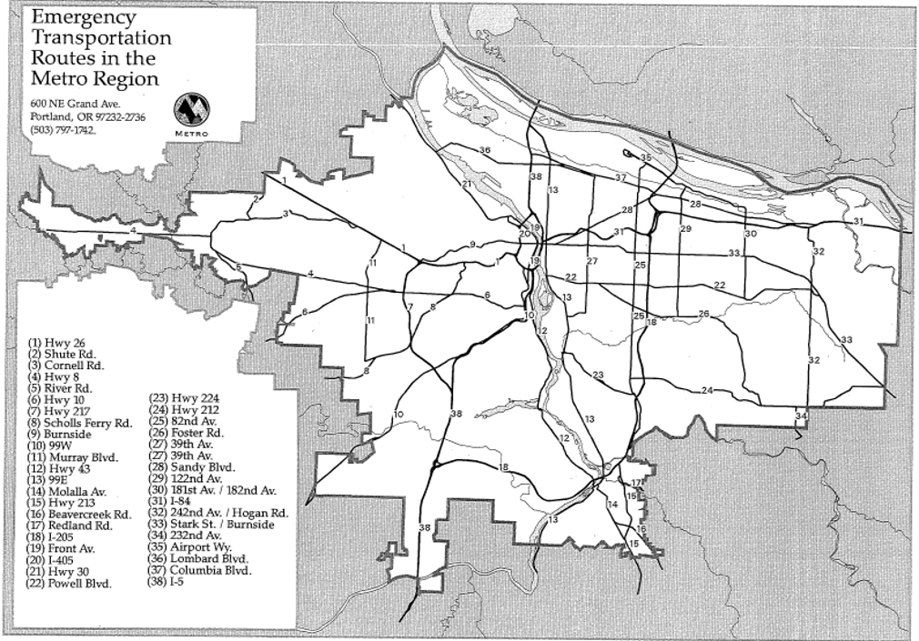
Emergency Transportation routes (1996)
The Regional ETR project was initially identified in Metro’s 2018 Regional Transportation Plan as a necessary step to better integrate transportation with planning for resiliency, recovery, and emergency response. Funding for the project was provided by the Urban Areas Security Initiative (UASI) grant from the Federal Emergency Management Agency (FEMA).
In Spring 2019, the Transportation Research and Education Center at PSU conducted a study to capture best practices for establishing emergency transportation routes in other regions, both within the US and internationally. They reviewed the policy frameworks that influenced the update of our regional ETRs. Read TREC’s findings and recommendations for the ETR project work group.
PHASE 1 (2019-2021)
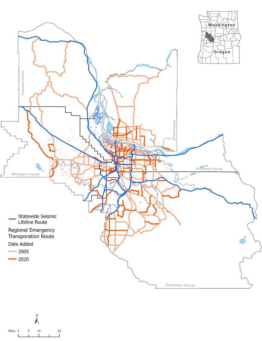
Regional Emergency Transportation Routes (2021)
Phase 1 ran from 2019-2021. The RDPO and Metro partnered to update the designated Regional ETRs for the five-county Portland-Vancouver Metropolitan Region, which includes Clackamas, Columbia, Multnomah and Washington counties in Oregon and Clark County in Washington. Before that, the last update occurred in 2006.
The project Methodology outlines criteria across three dimensions to identify the best regional routes for emergency response during a seismic event, and a six-step approach to validate the updated Regional Emergency Transportation Routes. The dimensions include:
1. Connectivity and Access: Assess RETR connectivity and access to regional assets and from state to local routes
2. Route Resilience: Assess resilience of RETR infrastructure to multiple natural hazards
3. Community and Equity: Assess RETRs for access to vulnerable and isolated communities
Phase 1 Dissemination Event: The Regional Emergency Transportation Route (RETR) Update team hosted a 90-minute dissemination event and Q&A on Wednesday, June 2, 2021 to provide partners with an overview of the RETR Update results as well as feedback from the 2021 regional review period. Team members introduced partners to the robust GIS data, tables, and charts that will enable regional emergency managers, transportation planners, and GIS analysts to put the RETR data layers to use.
PHASE 2 (2024-2026)
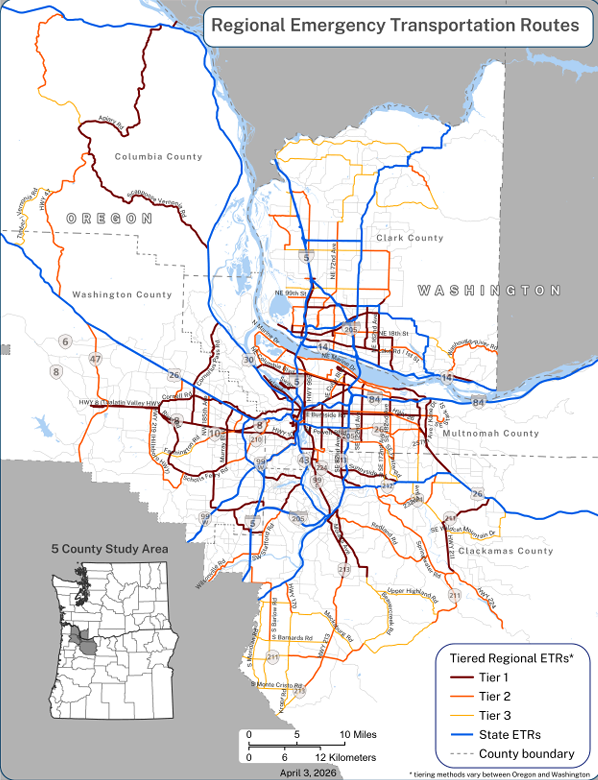
Tiered Regional Emergency Transportation Routes (2026)
Phase 2 of the Regional ETR project was identified as a follow on project to Phase 1 work in Metro’s 2023 Regional Transportation Plan. Phase 2 ran from 2024-2026, and was again co-managed by the RDPO and Metro.
This phase developed a methodology to prioritize and tier the updated Emergency Transportation Routes to guide ongoing maintenance and capital investments to ensure critical routes in our region are increasingly resilient. It also included a list of recommendations for ongoing and future work for the RETR project.
Targeted partner engagement took place through a series of workshops:
Technical workshops to include partners from fire, law enforcement, public works and utilities, transportation planning, and emergency management who have a response role in the immediate aftermath of a natural disaster or emergency event.
Community organization workshops as part of a larger Metro effort to engage community-based organizations across four Metro-led efforts, including RETRs. The purpose of these engagements is to understand the needs and priorities of disaster-vulnerable communities.
RESOURCES
Large-Format Maps
Clark County (For additional information about the tiering process in Clark County, visit Southwest Washington Regional Transportation Council’s Resiliency Assessment Plan page.)
PROJECT TEAMS
PROJECT WORK GROUP
The following partners have been actively engaged as core planning work group members in Phase 1 and/or Phase 2:
City of Portland
City of Vancouver
TriMet
C-TRAN
Portland State University (PSU) Transportation Research and Education Center (TREC)
Oregon Department of Transportation (ODOT)
Washington Department of Transportation
Oregon Department of Geology and Mineral Industries (DOGAMI)
RDPO
Metro
Clackamas County
Clark Regional Emergency Services Agency (CRESA)
Columbia County
Multnomah County
Washington County
City of Beaverton
City of Gresham
City of Hillsboro
PROJECT MANAGEMENT TEAM
Carol Chang, RDPO, carol.chang@portlandoregon.gov
John Mermin, Metro, john.mermin@oregonmetro.gov
CONSULTING TEAMS
PHASE 2
Fehr & Peers
Thuy Tu Consulting
Haley & Aldrich
PHASE 1
Thuy Tu Consulting
Salus Resilience
FLO Analytics
Cascade GIS & Consulting